
Customized Portfolio Projects
Key Highlights
Special Features Implemented to Our Client's GTFS Datasets.
GTFS Data Publication on Google Maps for Intercity Bus Operations in New York
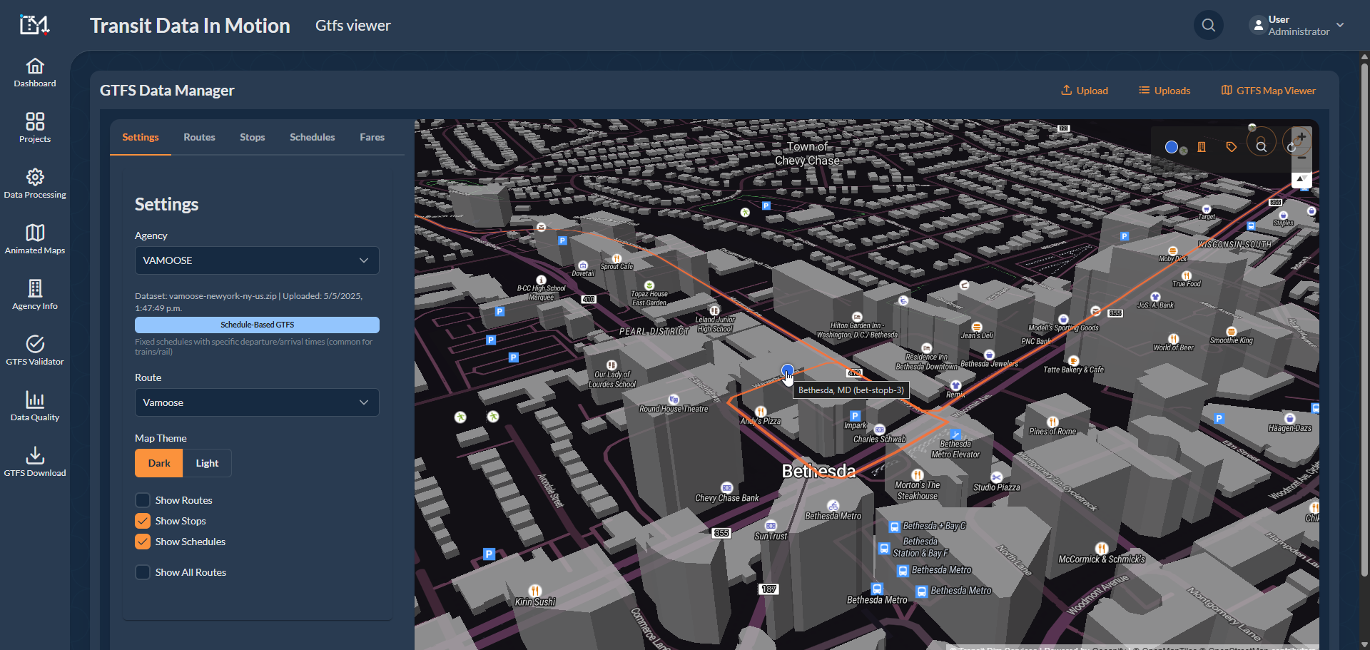


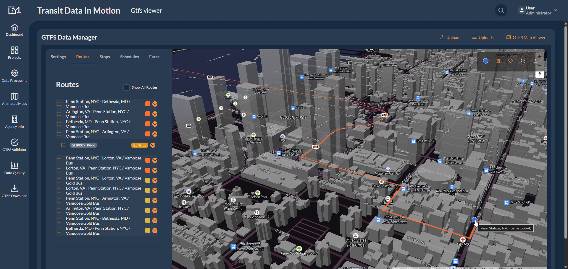

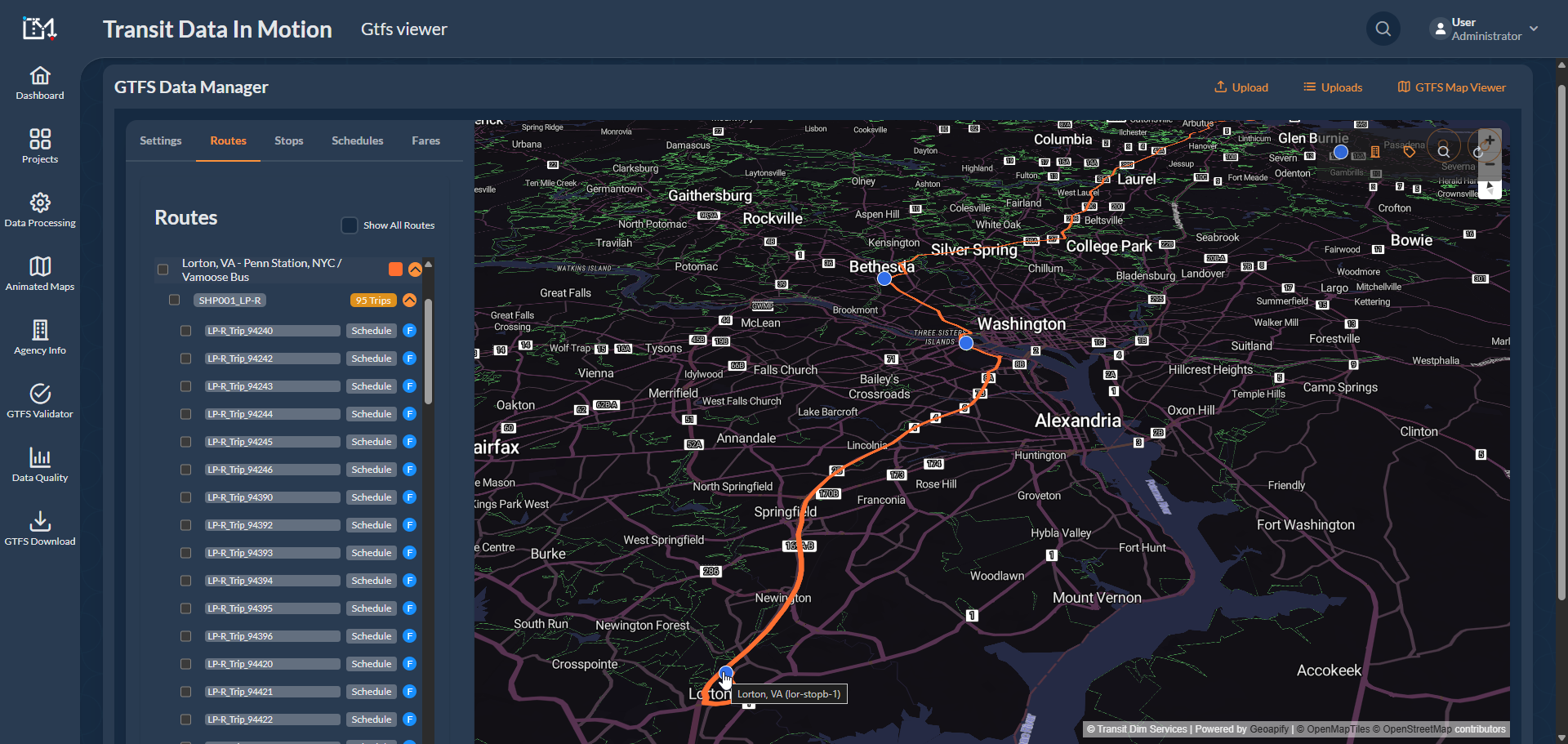

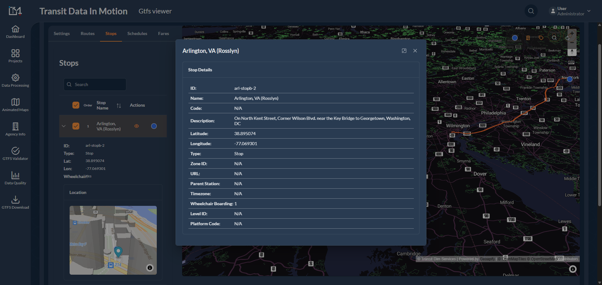


Special Feature: Created an API to enable the company's schedule dataset to communicate with our tools.
This project involved the creation of the General Transit Feed Specification (GTFS) for intercity bus routes running from the Washington DC area to New York.
The Special Feature created here was an Application Programming Interface (API) to enable the company's schedule dataset to communicate on real time with our tools. This allowed us to auto-generate an updated GTFS at any given time by simply running the API, ensuring current communication between the bus service and its users.
This project successfully combined technology and strategic planning to enhance the quality of intercity bus operations between Washington DC and New York, setting a standard in effective GTFS use for public transit visualization and route optimization.
Special Features Implemented to GoBoat.
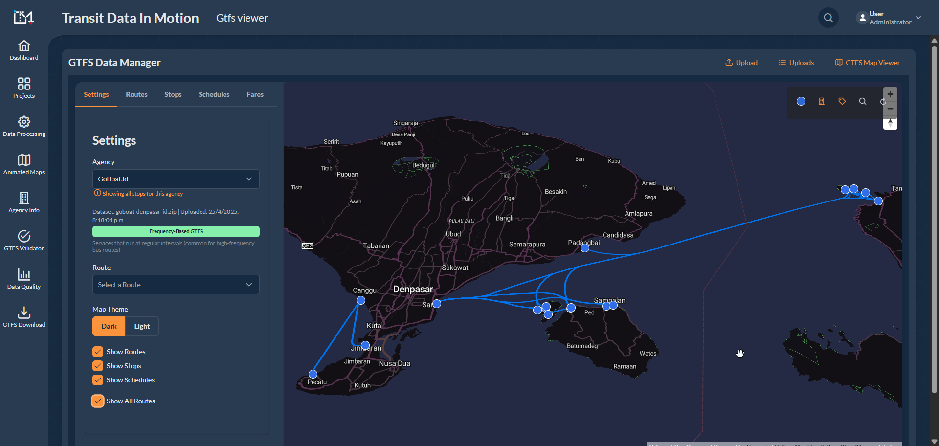
GTFS Data Publication on Google Maps for Fast Boat Travel in Bali, Indonesia
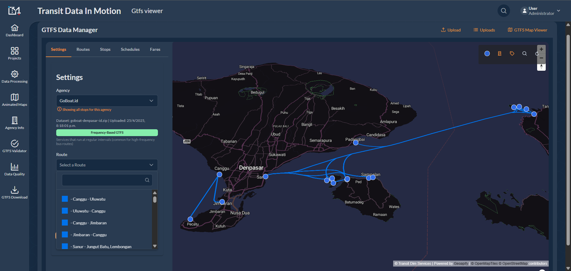
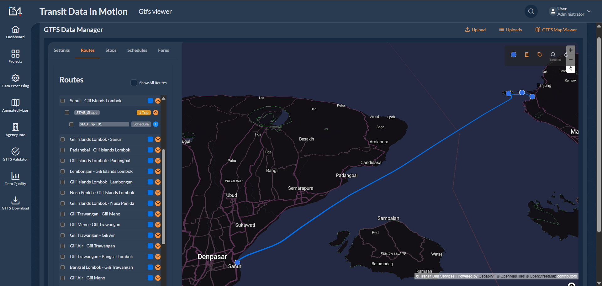


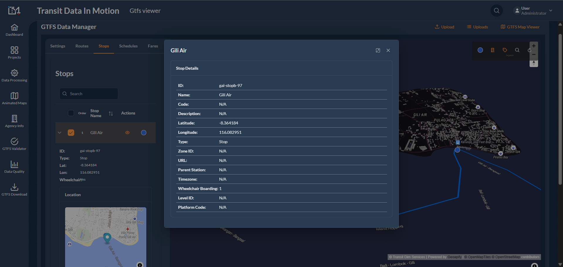


Special Feature: Implemented the Pathways and Levels option to the transit layout.
This project involved the design and implementation of a complete GTFS (General Transit Feed Specification) data integration system aimed at improving the transportation experience of fast boat travel between Denpasar, Penida Island, and within the Gili Islands area.
Pathways and Levels Application: Innovatively applied the Pathways and Levels option to the transit layout, enhancing route planning and navigation. This significantly improved walking instructions for users, leading them from site entrance to boarding site, increasing user experience and journey efficiency.
Through this project, we achieved significant improvement in the quality of fast boat travel around the Bali area through adept use of technology, stringent quality standards, and an unwavering commitment to enhancing user experience.
Special Features Implemented to Maple Bus.
GTFS Data Publication on Google Maps for Intercity Bus Services in Toronto, Canada
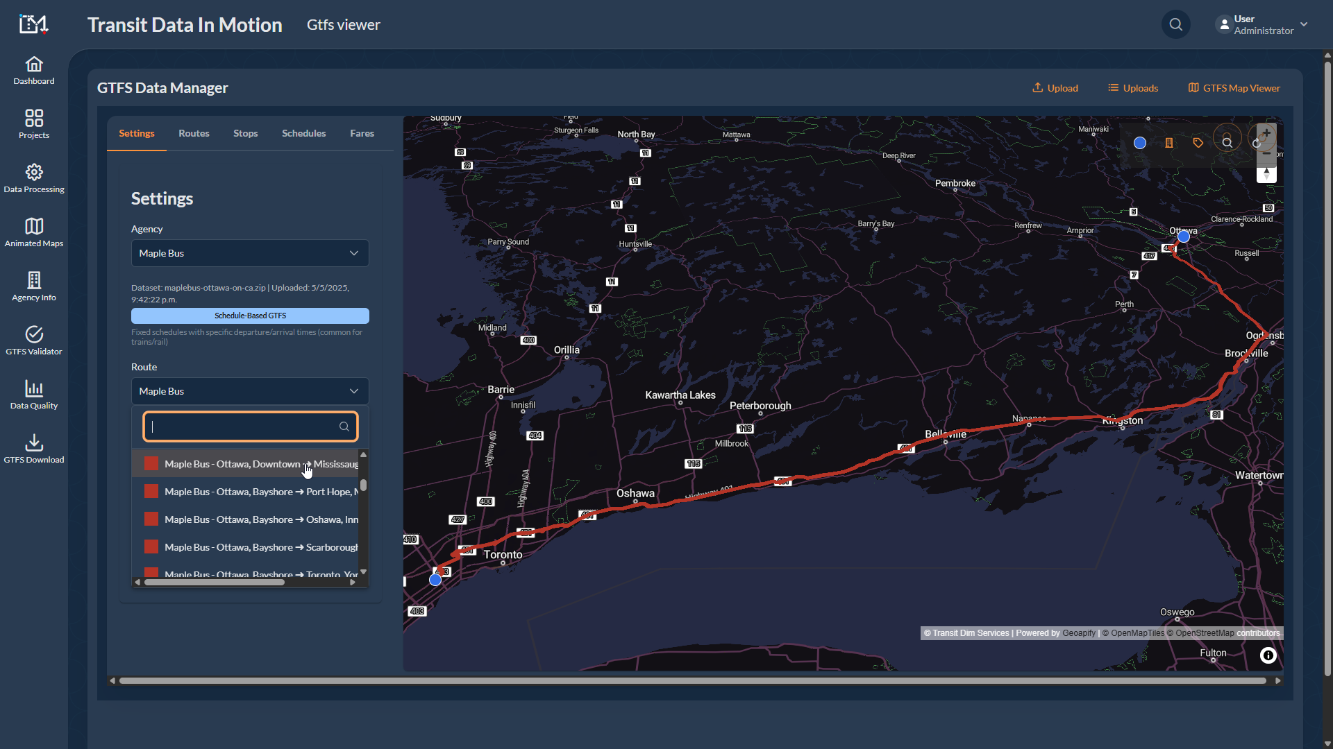
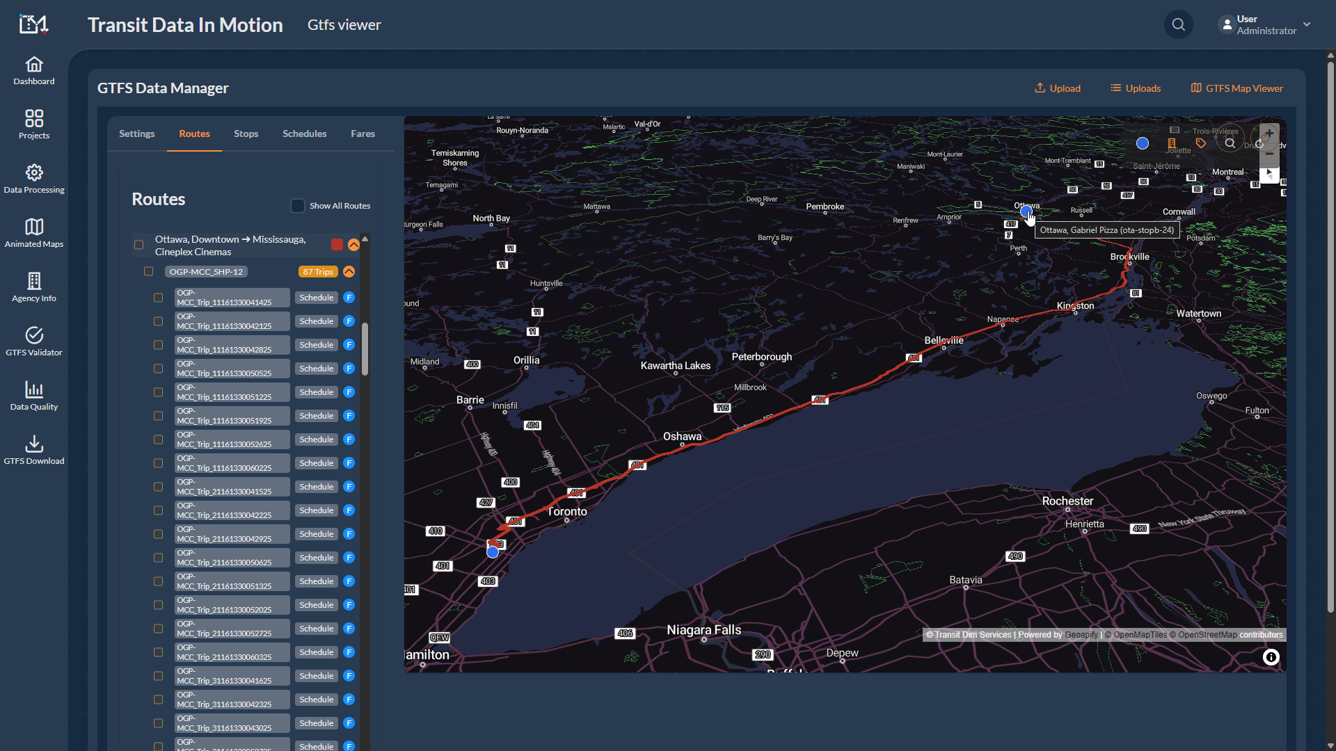

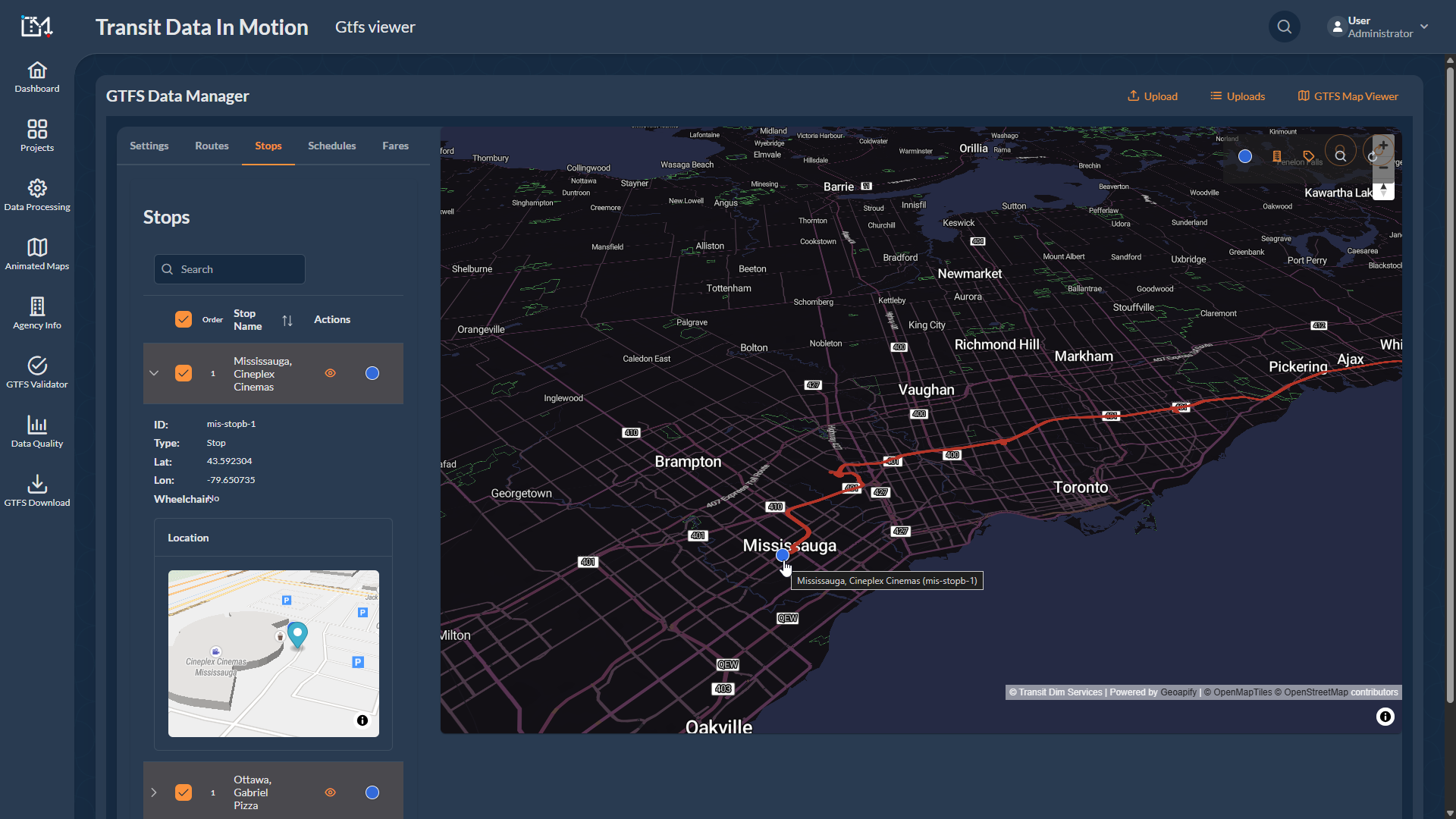

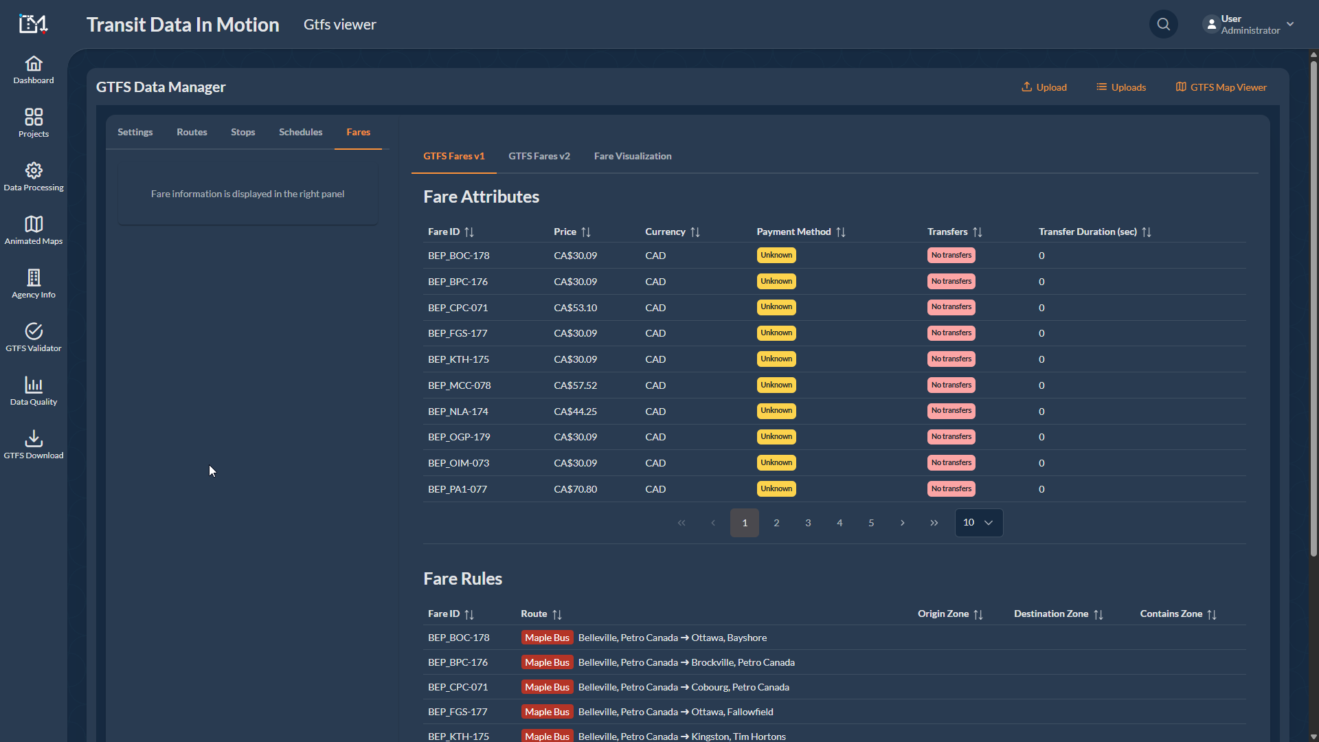
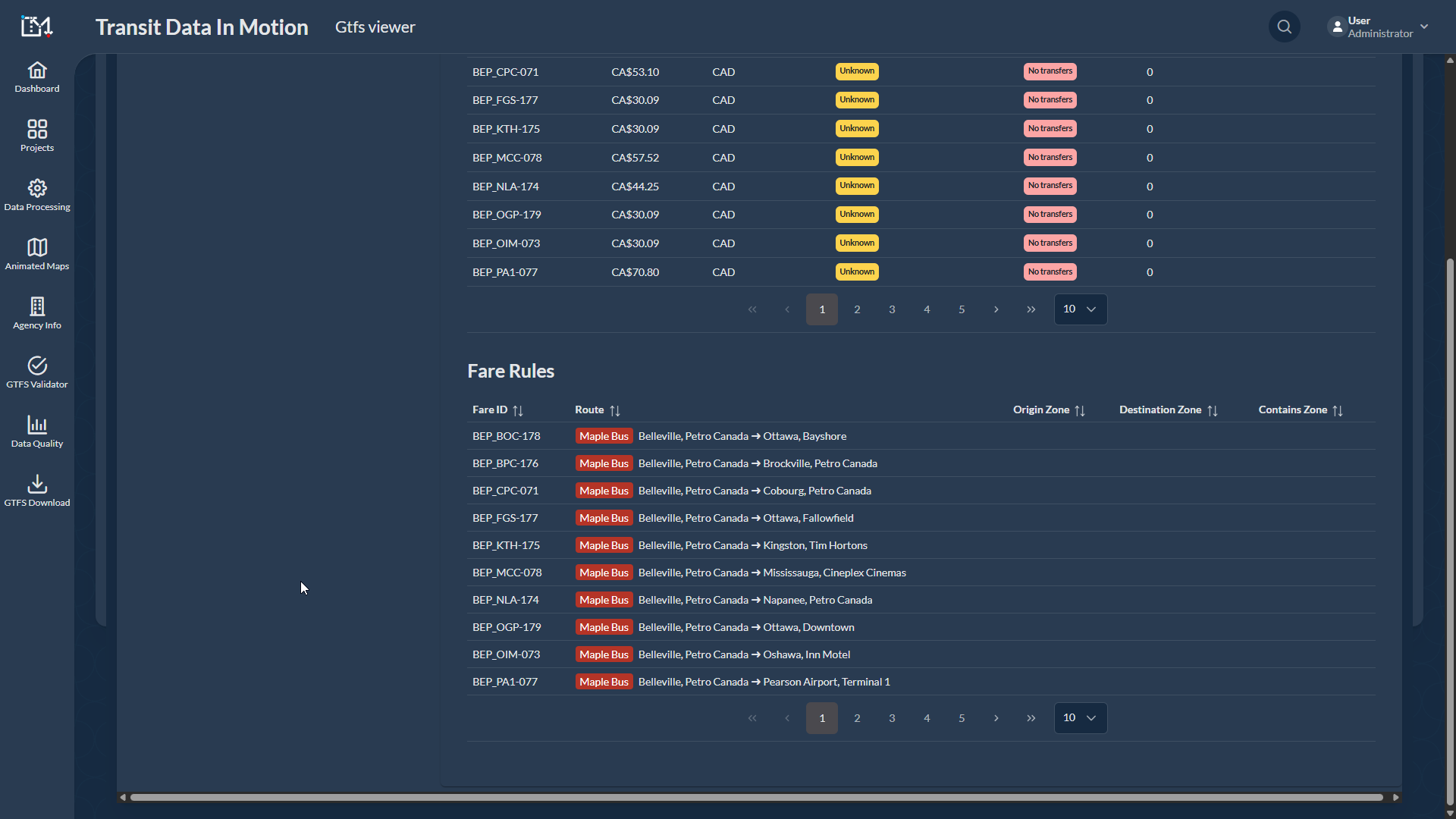

Special Feature: Deployed an API combined with n8n Automations to generate route line segments from an Origin-Destination & Fare matrix.
This project involved implementing General Transit Feed Specification (GTFS) for intercity bus routes connecting Toronto and Ottawa, Canada.
Deployed an API combined with n8n Automations designed to generate route line segments from an Origin-Destination & Fare matrix, taking a main parent shape and systematically generating child shape segments to accurately match fare specifics for respective trips.
Designed a utility linking the bus company's scheduling data to our tools, facilitating automatic GTFS generation through API execution.
Implemented Pathways and Levels option to enhance user experience by providing improved walking instructions within Toronto Pearson Airport, helping commuters navigate from multiple site entrances to designated bus boarding site.
Special Features Implemented to Souk to Surf.
GTFS Data Publication on Google Maps for Intercity Bus in Morocco, Africa.
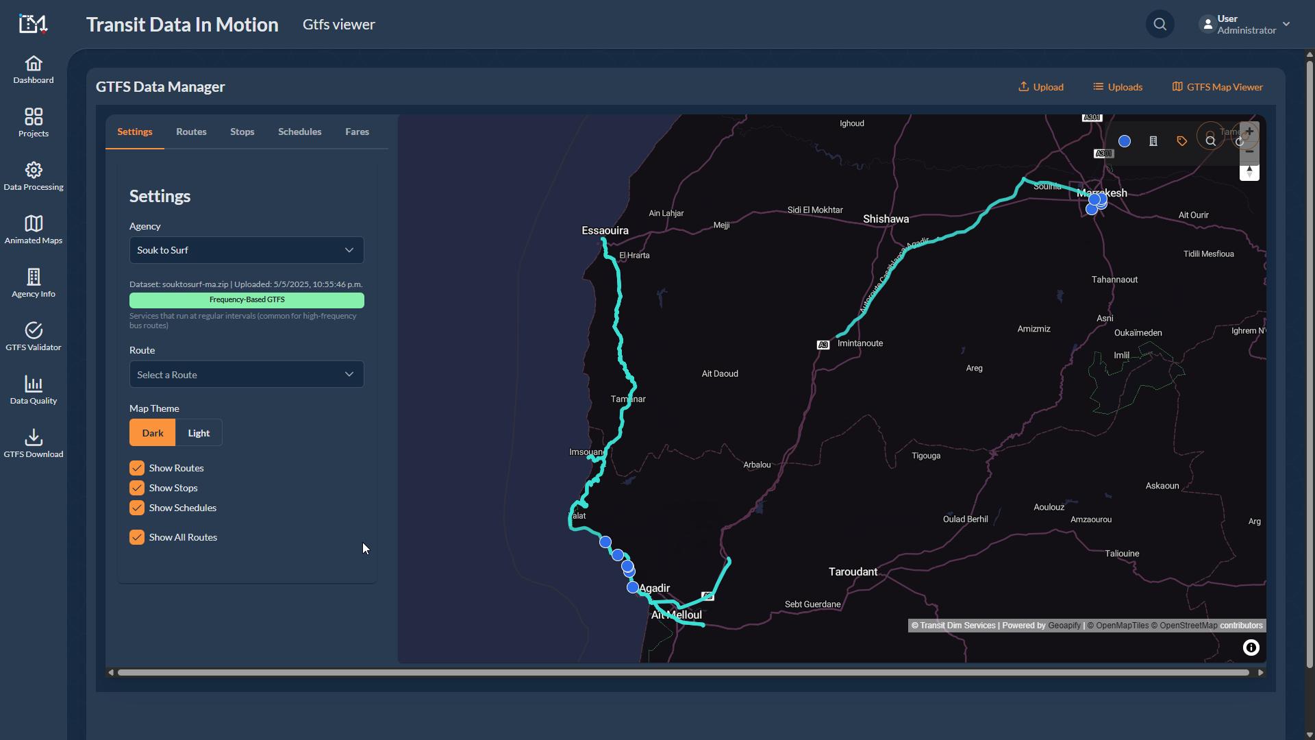

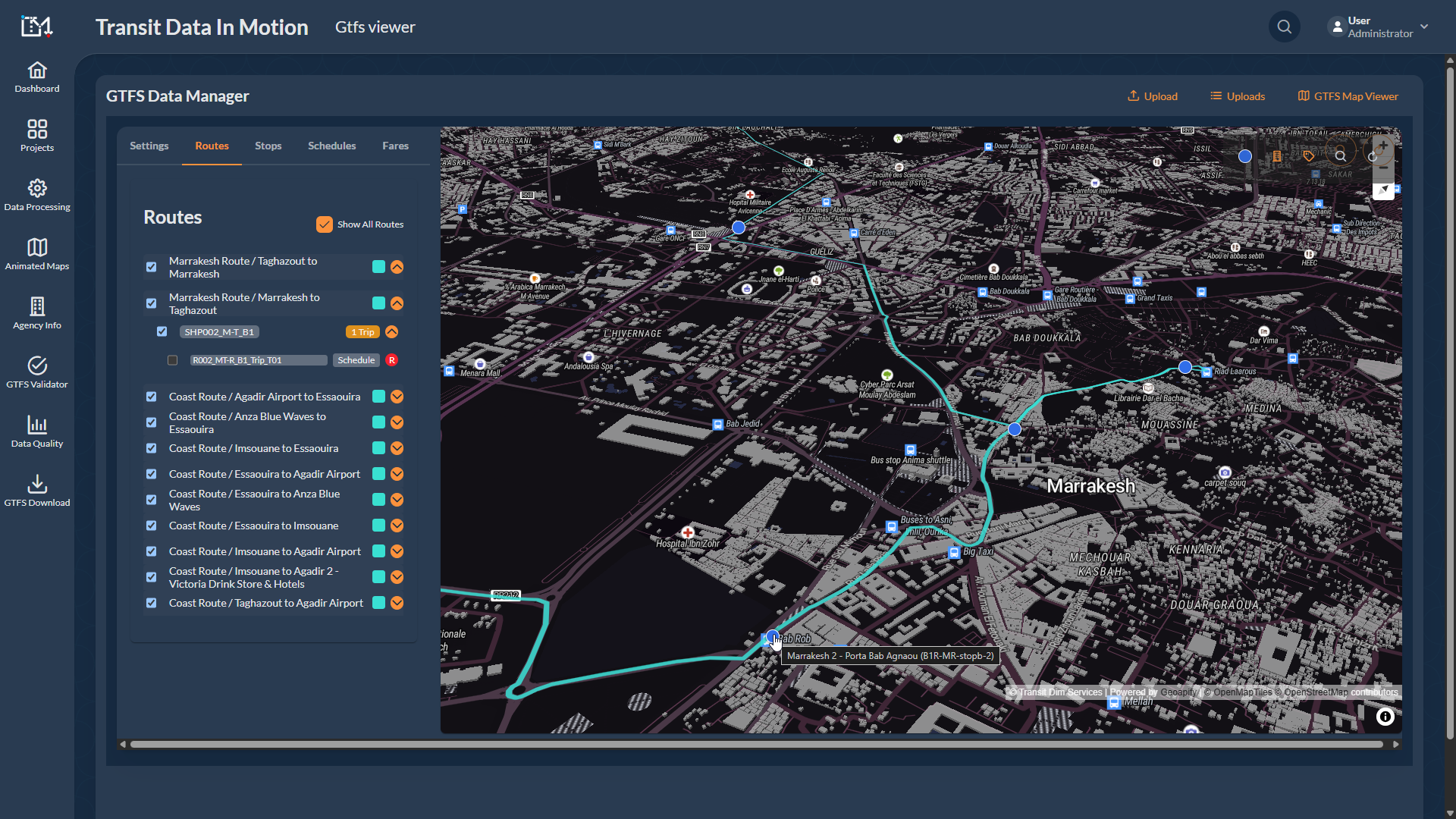
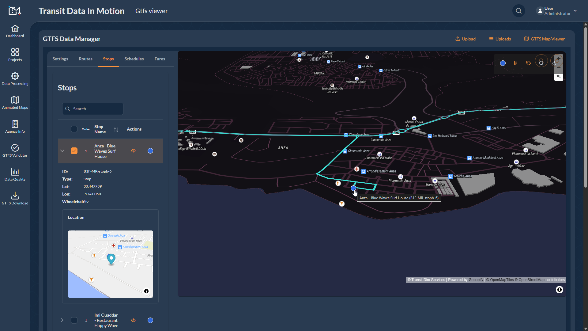
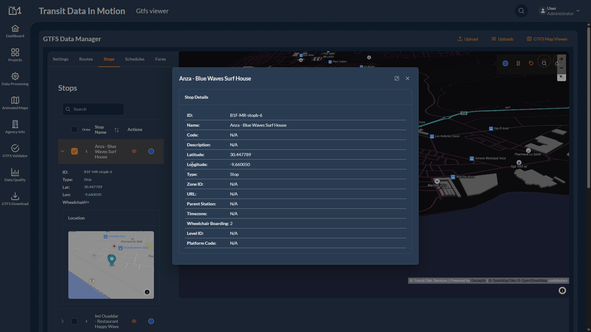
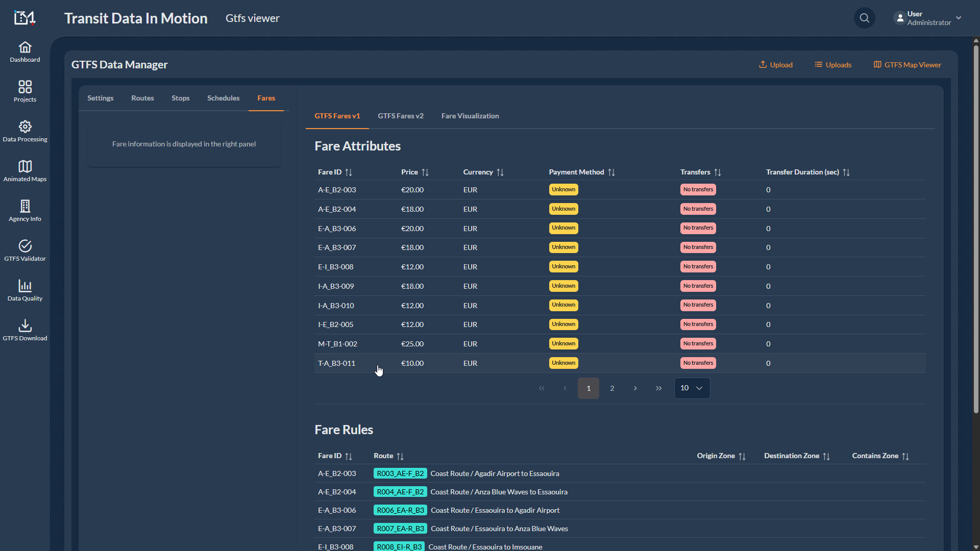

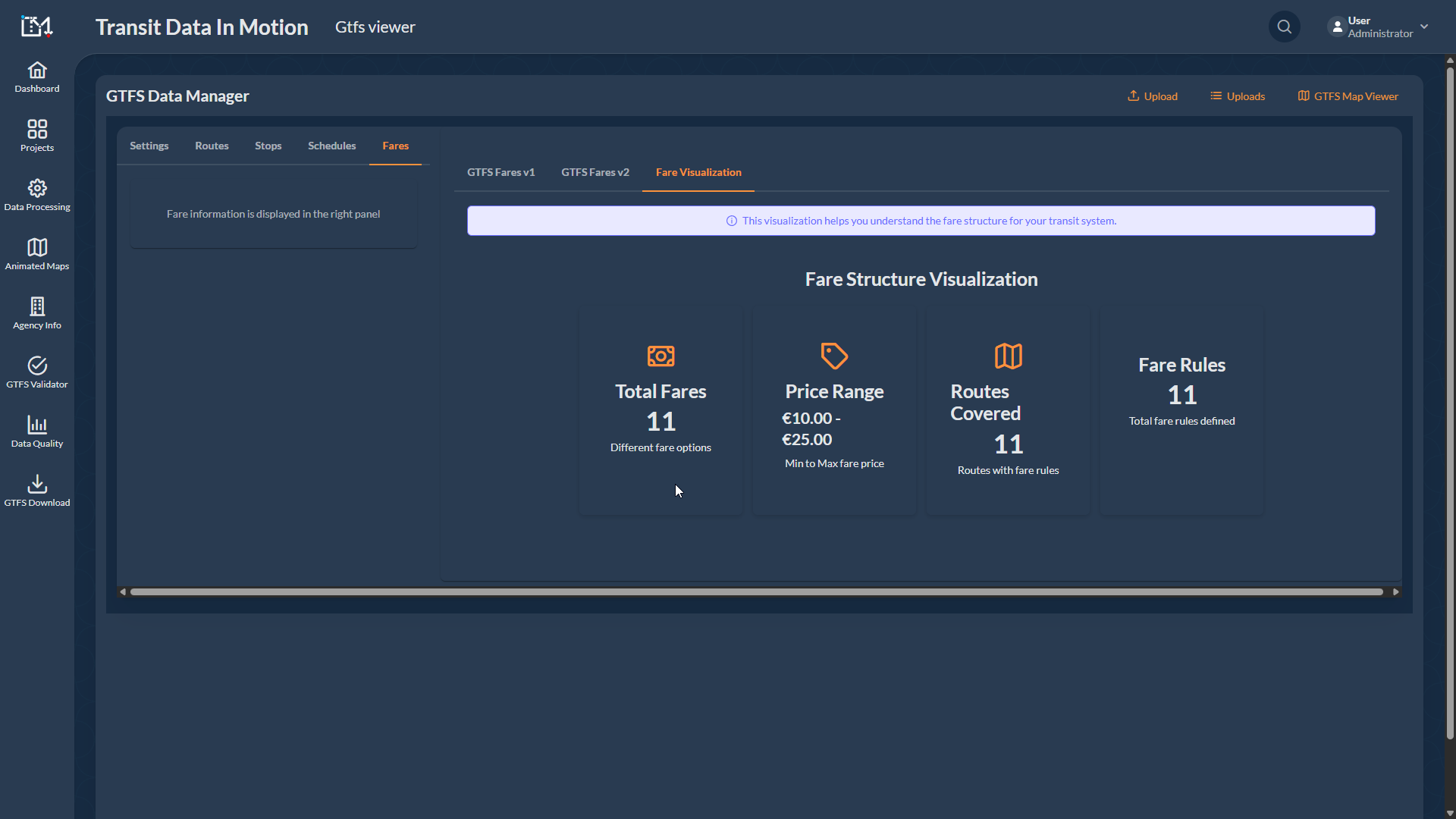
Special Feature: Remote Mapping with Automation Tools without extensive field work.
The Souk to Surf project centered on creating and publishing a comprehensive General Transit Feed Specification (GTFS) for intercity bus routes operating between various cities in Morocco and extending to Agadir and Essaouira regions.
Successfully uploaded the meticulously processed and verified transit data to Google Transit, marking the achievement of creating a GTFS for intercity bus routes in Morocco and publishing it on Google Maps is under process.
This project bridged the gap between travelers in Morocco and the west Africa coast by providing reliable and accurate public transport data via Google Maps, facilitating easier transportation within the continent.
Special Features Implemented to Transfluvial.
GTFS Data Publication on Google Maps for Ferry Service in Seville, Spain
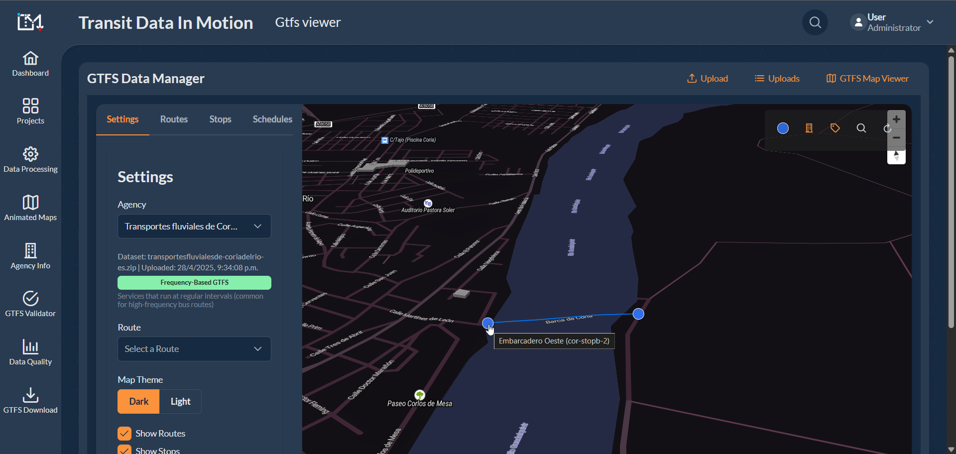
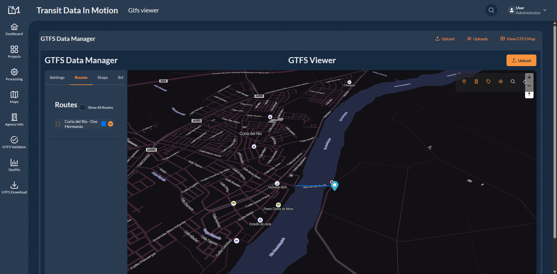

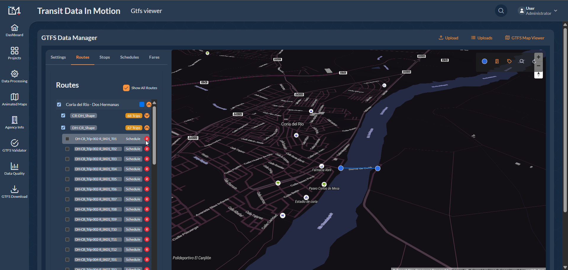

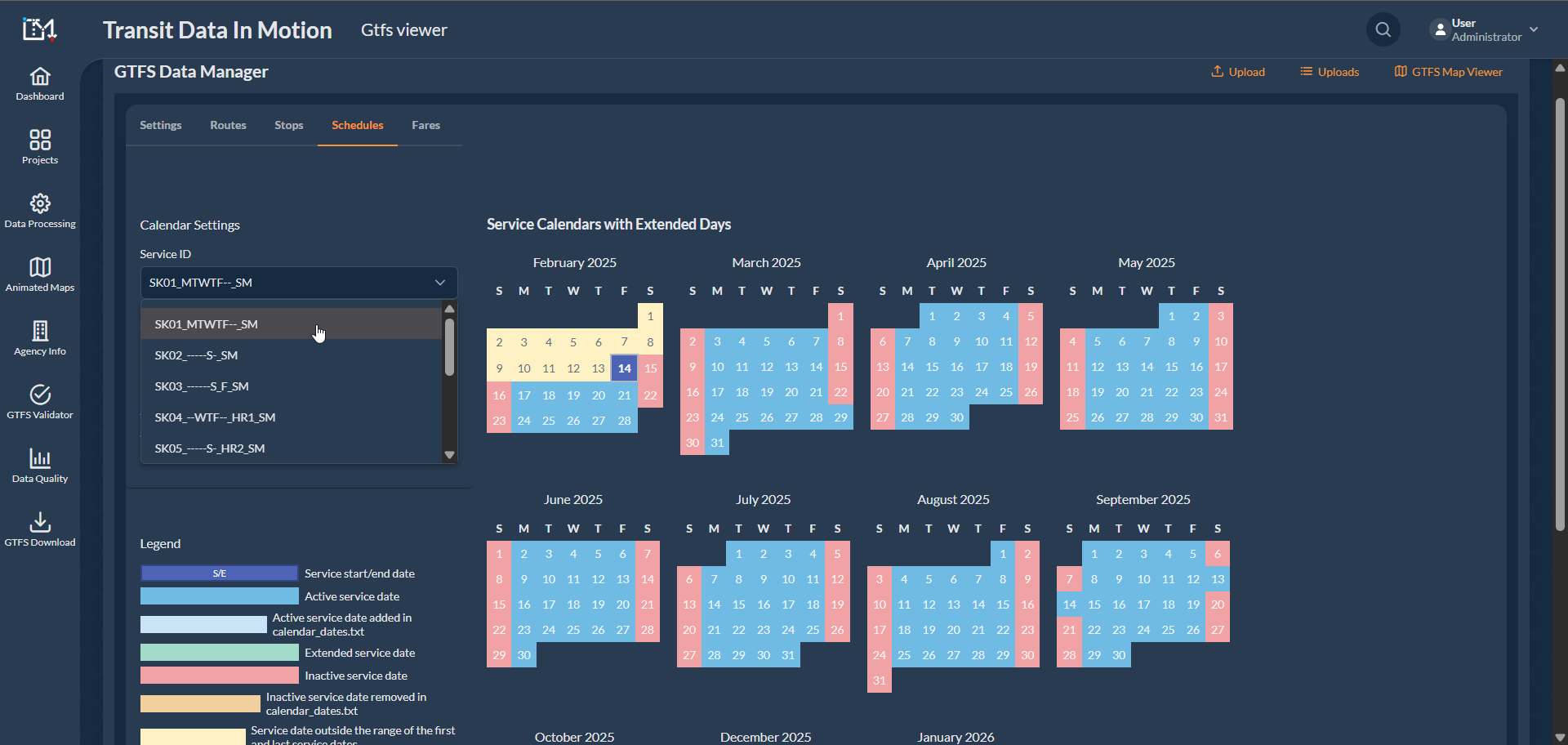

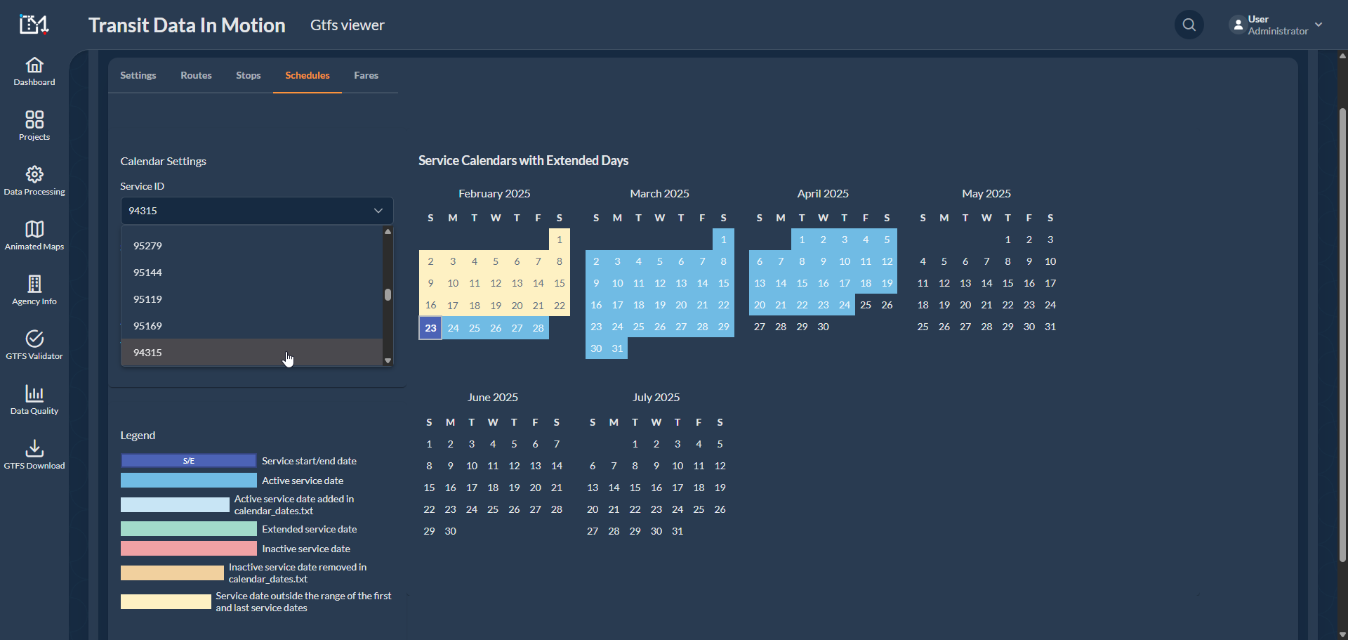
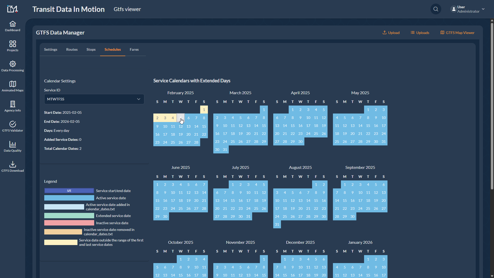
Special Feature: Created a detailed, frequency-based schedule for multiple service variations.
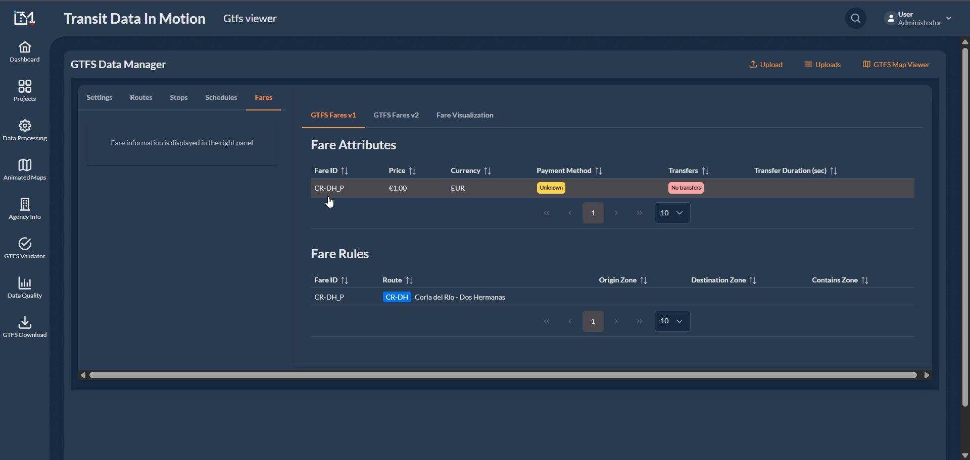
This project involved generating a comprehensive GTFS (General Transit Feed Specification) for Transfluvial, a well-known ferry service provider that has been serving the people of Coria del Río, Seville, Spain since 1970. This firm specializes in river transportation and primarily facilitates transit across the Guadalquivir riverbanks.
Greatest Challenge: The most demanding aspect was crafting a detailed, frequency-based schedule that accounted for service variations due to seasonal factors, off days, holidays, and regular weekday operational hours.
This project resulted in the successful publication of comprehensive and accurate GTFS data for Transfluvial's ferry service on Google Maps, enhancing accessibility and ease of transit for local commuters in Coria del Río.
Special Features Implemented to Wavy Bus.
GTFS Data Publication on Google Maps for Intercity Bus from Essaouira to Lisbon


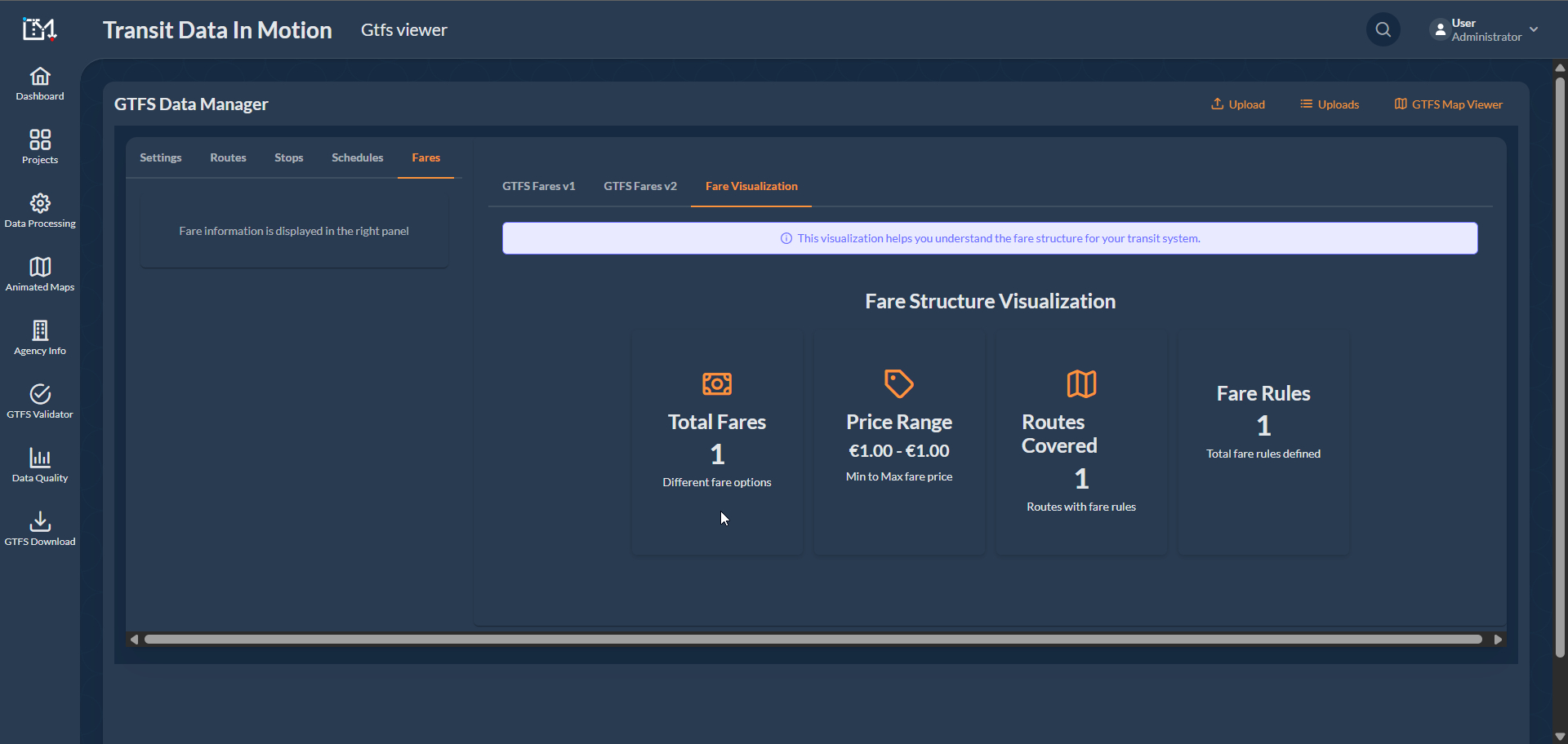
Special Feature: Applied the Interactive Visualization System to analyze Bus Routes.
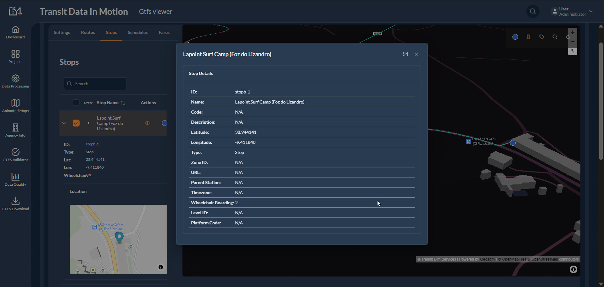
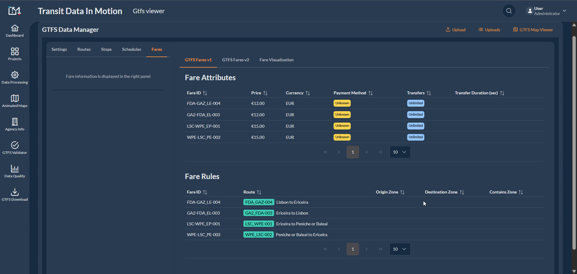
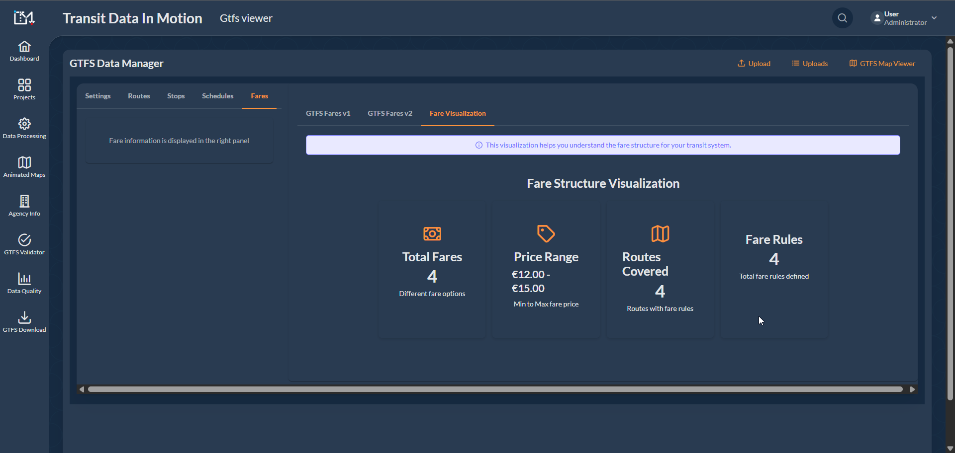
The Wavy Bus project focused on developing and executing GTFS data publishing on Google Maps for intercity bus journeys between Essaouira and Lisbon, optimizing the transit experience for passengers in Portugal.
Applied the Interactive Visualization System to analyze Bus Routes following bus displacement along the routes.
This successful project demonstrated proficiency in GTFS creation, database design, data processing, quality assessment, remote mapping, and automation tool usage providing a superior travel planning resource on one of the most popular navigation platforms worldwide.